Page 1 of 1
Route mapping software
Posted: Mon Oct 17, 2022 7:42 pm
by sakm
After a bit of discussion on the
Annual meet 2023 Discussion Thread about route planning software I thought I would start a new topic on it for discussion
What route planning software do you use and what sat nav, Device or system are you using?
I am using a Garmin Zumo XT I have used Basecamp a fair few times and it is clunky and not very intuitive but once you learn how it works its actually pretty good
But! Theres always a but

I prefer to use MyRoute App I paid for the lifetime membership about a year or two ago but the main reasons for me using this is the fact that its all online based you can access it from any computer or smart phone and I can plan, create and edit routes while out and about on the bike or while sat talking in the pub on a night if you so wish just make sure you don't have too many shandy's
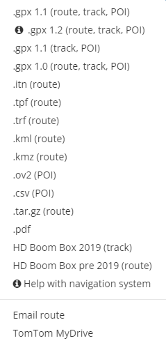
I can then send routes easily to the Zumo from my phone or computer. You can send/save routes in many different extensions and include routes tracks and POI's see image below
- 2022-10-17 19 39 15.png (23.61 KiB) Viewed 651 times
Another added bonus for me is that I can create a group and add friends to it to easily share routes with them so they can see the routes and download them to their sat nav too
So what do you use and why? remember there is no wrong answers here just an insight in to what is actually out there and what benefits they have and how they integrate to the system you use
Feel free to also start a new topic to open up discussion about a specific software if you want more information or any tips/tricks too
Re: Route mapping software
Posted: Tue Oct 18, 2022 4:00 am
by David.
I use BaseCamp with a Garmin Zumo 660.
I look at a paper road atlas to decide where I want to go and on which roads. In BaseCamp, start & finish waypoints are created, then the bespoke route is created by adding shaping points. Where necessary, Google maps is used to check the location of waypoints and road conditions. The route can be saved as a .gpx or .gdb file and shared with others via email. I've done this for the last 11 years, previously using MapSource which I still have a copy of. Routes are regularly shared with a.n.other who has a BMW Nav. VI. On the very rare occasions I need to build a route up when out and about, I just create it on the sat. nav. in conjunction with a road atlas. All works just fine.
I prefer to plan my own routes rather than have some GPS profile or mapping/route planning software do it for me.
Re: Route mapping software
Posted: Tue Oct 18, 2022 8:05 am
by Steve398
For years I successfully used Tyre, the forerunner to MyRoute, and was subjected to constant emails urging me to upgrade whilst the original became slower and more clunky.
In the end I did upgrade and found it to be all they promised. It is fast and efficient, but whereas Tyre was free MyRoute most certainly isn’t and I had to buy Gold level to enjoy the full benefits.
However all Sakm says is true, a superb planning tool that works well with my Tomtom 550 so no regrets.
Re: Route mapping software
Posted: Tue Oct 18, 2022 9:53 am
by David.
My Zumo 660 was purchased in 2011, at the time they didn't come with lifetime map updates.
Two years later in 2013, I paid Garmin £75 for lifetime map and BaseCamp updates. That's just over £8 per year so far and decreasing every year onwards.
Re: Route mapping software
Posted: Tue Oct 18, 2022 7:45 pm
by simbo
Tourstart.org for me. Really easy to use and transfer routes to my nav. If I want to share the route I've created I can just download it to my laptop and email to anyone (self included) and email from my phone wherever I am.. I'm also becoming a fan of the Connected ride app on my phone, I can create routes using the app and share them (gpx file) via any sort of messenger service. It also records every ride you do and saves all the statistics like speed, lean angles, G forces, altitudes and more, it also links any photo's you take with each ride. It really is a brilliant app and getting better with every update. I haven't used my Nav6 since getting the cradle for the Connected ride. The only drawback is you need a TFT bike to use it
Re: Route mapping software
Posted: Tue Oct 18, 2022 8:40 pm
by exportman
Steve398 wrote: ↑Tue Oct 18, 2022 8:05 am
For years I successfully used Tyre, the forerunner to MyRoute, and was subjected to constant emails urging me to upgrade whilst the original became slower and more clunky.
In the end I did upgrade and found it to be all they promised. It is fast and efficient, but whereas Tyre was free MyRoute most certainly isn’t and I had to buy Gold level to enjoy the full benefits.
However all Sakm says is true, a superb planning tool that works well with my Tomtom 550 so no regrets.
Same route used Tyre from almost its first release. Upgraded to MyRoute App early on Lifetime gold membership for not a lot of money.
Easy to use tool you can check your route in simulations of several sat nav types. Exports to just about every commercial device
W have a group of around 50 members all of whom can access to areas of our section of MRA and download the routes. Being able to set up groups means you can be selective on who has access to which routes. Most of our group are using the free version which is fine for basic mapping or downloading pre constructed routes.
Re: Route mapping software
Posted: Thu Oct 20, 2022 2:39 pm
by BoB21
Nav 5 as free with new bike, use basecamp. only downside is took a little while to get to grips with but now have a great libary built up of routes/waypoints/cafes etc. Downloaded most of ride magazines routes as guides. Take on board about not being able to plan routes on the road, so tried calimoto on phone and just found routes down main roads and could do better with local knowledge or trial and error. That could be partly down to living on south coast. Overcame shortfall by just plotting diffrent options in basecamp with waypoints at convienent places to jump from one planned route to another.
As stated elswhere if just A to B rider basecamp not for you, if high milage and like unclassified /scenic roads basecamp is worth persavering with. It also has ability to plan walking routes as well as ski lifts into routes.
Re: Route mapping software
Posted: Thu Oct 20, 2022 2:49 pm
by David.
BoB21 wrote: ↑Thu Oct 20, 2022 2:39 pm Now have a great library built up of routes/waypoints/cafes etc.
This is "My Collection" within BaseCamp of the UK, it's fairly well populated.

Re: Route mapping software
Posted: Thu Oct 20, 2022 4:12 pm
by yorkie
David. wrote: ↑Thu Oct 20, 2022 2:49 pm
BoB21 wrote: ↑Thu Oct 20, 2022 2:39 pm Now have a great library built up of routes/waypoints/cafes etc.
This is "My Collection" within BaseCamp of the UK, it's fairly well populated.
You obvously need to go on a diet
Re: Route mapping software
Posted: Fri Oct 21, 2022 5:43 am
by BoB21
Heres mine on the show me yours thread. Hmm cant attach uk as file to big.
p.s Ive only been on basecamp for 5 years and still learning.
Re: Route mapping software
Posted: Fri Oct 21, 2022 7:05 am
by David.
